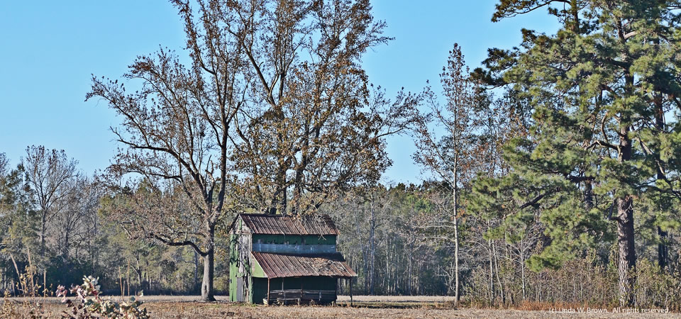
It looks like a rehab is in the works at this old barn in the Browntown community in lower Florence County, writes Kingstree, S.C., photographer Linda W. Brown.
Copyrighted photo taken Dec. 26, 2014. All rights reserved.
The Center for a Better South
It looks like a rehab is in the works at this old barn in the Browntown community in lower Florence County, writes Kingstree, S.C., photographer Linda W. Brown.
Copyrighted photo taken Dec. 26, 2014. All rights reserved.
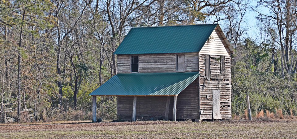
Trees shelter a vintage barn in Clarendon County, S.C., off Newman Branch Road.
Clarendon County has 34,357 people, according to the U.S. Census Bureau’s 2012 population estimate. About half of the county’s residence are white; the other half are black.
Photo taken in 2014 by Linda W. Brown. Copyrighted; all rights reserved.
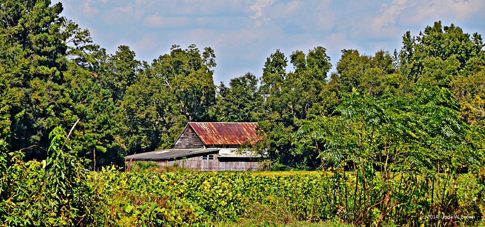
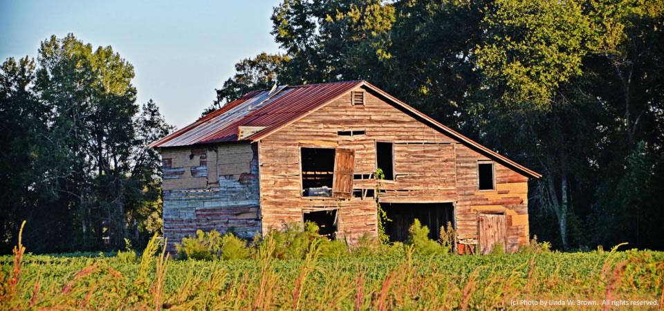
This rusting, old barn overlooking a soybean field looks like autumn to photographer Linda W. Brown of Kingstree, S.C. The barn is in rural Florence County.
Florence County had 137,948 people, according to a 2012 Census estimate. Its poverty rate — higher in the rural areas than the county seat of Florence, averaged 19.4 percent in 2010.
Copyrighted photo taken in October 2014 by Linda W. Brown. All rights reserved.
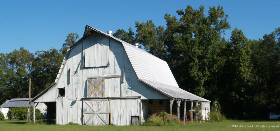
Across much of the South, overt symbols of the past, such as the Confederate battle flag, are slowly fading into the past, much like the paint on this barn at Confederate Farm in the western part of Colleton County, S.C., on S.C. Highway 641.
Along the edge of the Southern Crescent, Colleton County is split by Interstate 95, which makes it poised for growth. Still, lots of the large county is rural. Walterboro is the seat of government in Colleton County, which is home to 38,153 people, 21 percent of whom live at or below the federal poverty level.
Photo taken Oct. 1, 2014, by Andy Brack. All rights reserved.
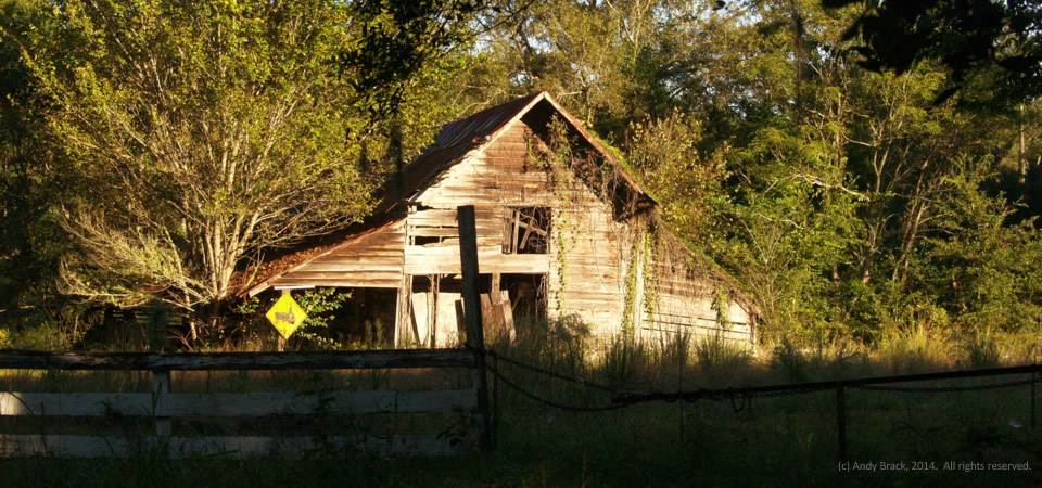
Note how the early morning sunlight made this old barn pop out of the shadows along S.C. Highway 264 near Jacksonboro, S.C., in rural Colleton County.
Along the edge of the Southern Crescent, the barn reflects a time gone by in a county that is poised for growth because of its proximity to Interstate 95 and the Charleston metropolitan area.
Walterboro is the seat of government in Colleton County. It is home to 38,153 people, 21 percent of whom live at or below the federal poverty level.
Photo taken Oct. 1, 2014, by Andy Brack. All rights reserved.
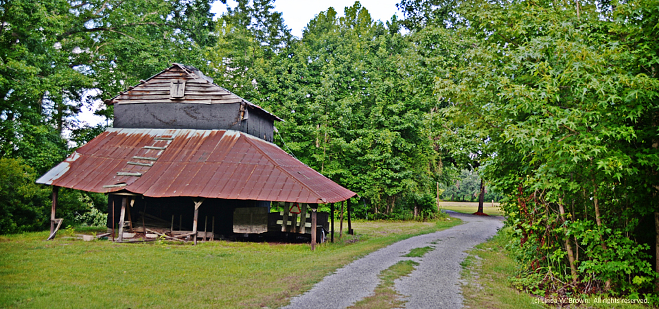
An old barn and a country lane beckon the passerby to see what’s around the bend just off Cedar Swamp Road in rural Williamsburg County, South Carolina.
This old barn on Roper Woods Road in eastern Williamsburg County, S.C., is giving way to time, writes photographer Linda W. Brown of Kingstree. The photo was taken earlier this spring when the winter wheat crop in the foreground was green.
Williamsburg County, which is about 75 miles north of Charleston, S.C., has a population of just under 34,000 people. Population peaked in 1950 at 43,807, but has dropped slowly since then.
About two-thirds of county residents are black, with almost all of those remaining being white. Only 2 percent of those in the county are of Hispanic descent. Some 32.8 percent of residents live in poverty, according to the Census. Of the county’s 1,92
1 firms, 36.5 percent are black-owned — a percentage that is three times South Carolina’s average.
Copyrighted photo by Linda W. Brown, taken in Spring 2014. All rights reserved.
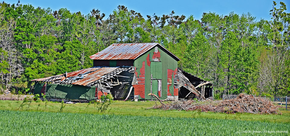
Not only does the autumn sunlight dance warm shades and shadows on this old barn off McIntosh Road in Williamsburg County, S.C., but it highlights how the barn is in the autumn of its days, according to retired editor Linda W. Brown.
Such pastoral scenes dot the landscape of the Southern Crescent to reflect two realities — the relaxed beauty of the area and the slow decay of infrastructure that once powered the rural South.
Just under 34,000 people live in Williamsburg County, which is about the number who lived there in 1900, according to Census figures. Population peaked in 1950 at 43,807, but has dropped slowly since then.
About two-thirds of county residents are black, with almost all of those remaining being white. Only 2 percent of those in the county are of Hispanic descent. Some 32.8 percent of residents live in poverty, according to the Census. Of the county’s 1,921 firms, 36.5 percent are black-owned — a percentage that is three times South Carolina’s average.
Photo taken Sept. 27, 2013, by Linda W. Brown. All rights reserved.
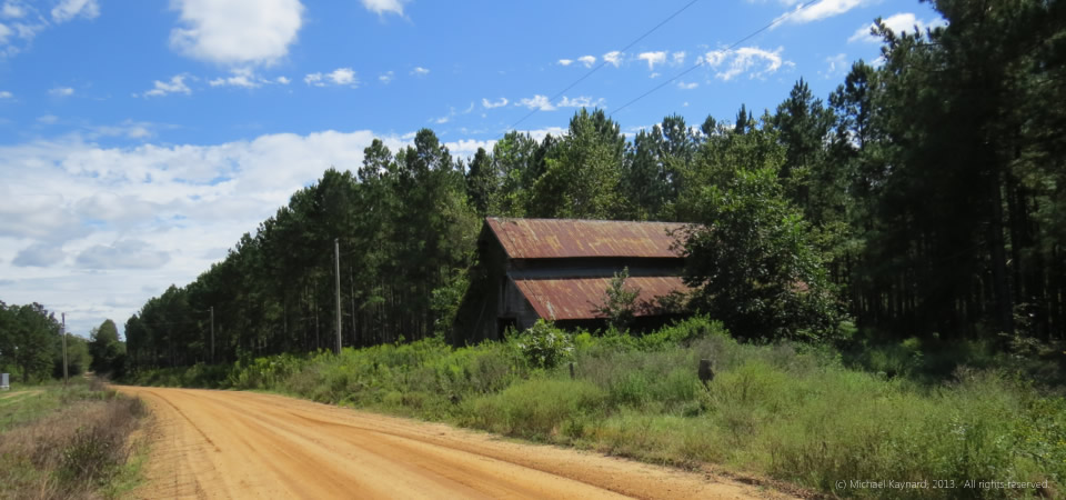
Orange dirt roads. Pine trees. Cotton fields. This photo evokes the writing of Georgia’s Erskine Caldwell. It was taken in Georgia’s cotton country just north of the intersection of U.S. Highway 80 and Georgia Highway 121 in Emanuel County.
According to the Cotton Council International 2013 Buyers’ Guide, Georgia farmers grew more than 15 percent of the nation’s cotton in 2011-12 by producing 2.465 million bales. The only state that grew more cotton was Texas, which produced 3.5 million of the nation’s 15.573 million bales in 2011-12.
Emanuel County,located north of Statesboro, Ga., has almost 23,000 people and a poverty rate of 24.5 percent, according to the U.S. Census.
Photo taken Sept. 23, 2013, by Michael Kaynard. All rights reserved.
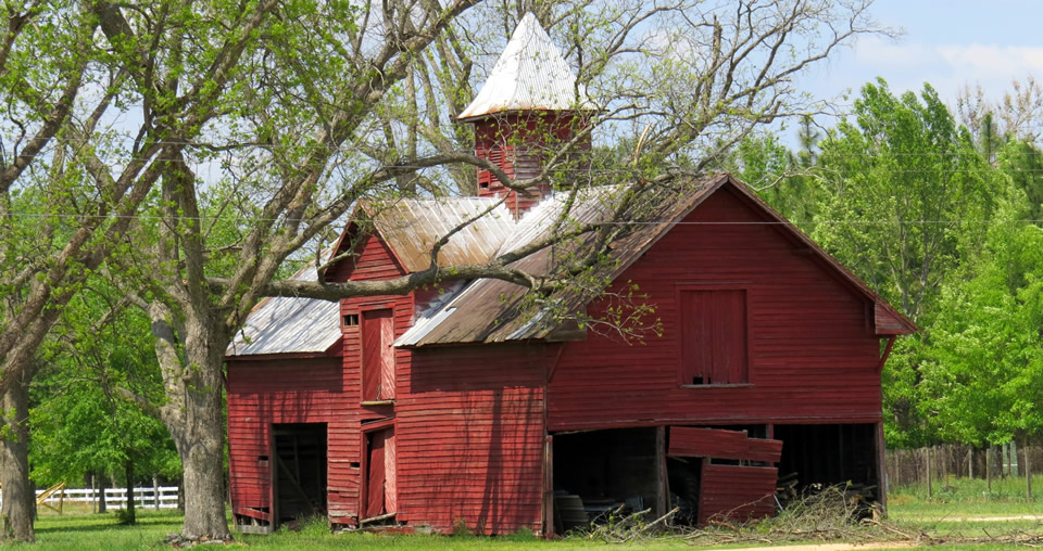
Photographer Michael Kaynard of Charleston, S.C., writes that this stereotypical barn off U.S. Highway 15 south of Bennettsville, S.C., continues to shelter equipment used on an adjacent farm. “I was drawn to the design. It was quite a fancy design for a barn.” Across the rural South, more and more barns are being lost to progress.
Bennettsville is the county seat for Marlboro County, where almost 29 percent of residents live below the federal poverty line. The county had 28,145 residents in 2012, 51 percent of whom were black, according to Census estimates.
Photo by Michael Kaynard. All rights reserved. Originally posted April 25, 2013.