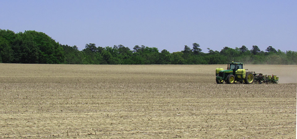
Fields across the South are sprouting corn and other crops or getting prepped, as highlighted in this photo of a Calhoun County, S.C., farmer plowing in the Sandy Run community along U.S. Highway 176. Continue reading “It’s that time of the year”
The Center for a Better South
Fields across the South are sprouting corn and other crops or getting prepped, as highlighted in this photo of a Calhoun County, S.C., farmer plowing in the Sandy Run community along U.S. Highway 176. Continue reading “It’s that time of the year”
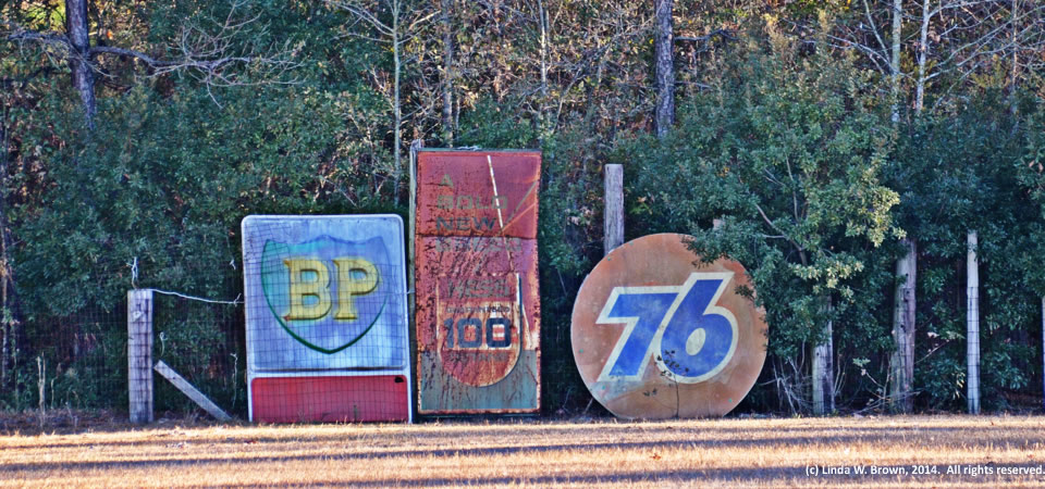
Kingstree, S.C., photographer Linda W. Brown spied these old signs along a fence of what she thought seemed to be an abandoned baseball field in rural Clarendon County, S.C.
Clarendon County has 34,357 people, according to the U.S. Census Bureau’s 2012 population estimate. About half of the county’s residence are white; the other half are black.
Photo taken in 2014 by Linda W. Brown. Copyrighted; all rights reserved.
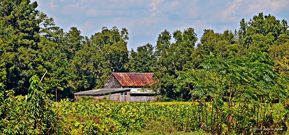
This rusting, old barn overlooking a soybean field looks like autumn to photographer Linda W. Brown of Kingstree, S.C. The barn is in rural Florence County.
Florence County had 137,948 people, according to a 2012 Census estimate. Its poverty rate — higher in the rural areas than the county seat of Florence, averaged 19.4 percent in 2010.
Copyrighted photo taken in October 2014 by Linda W. Brown. All rights reserved.
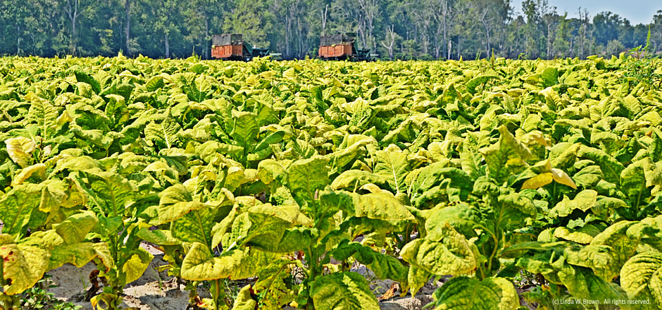
Although tobacco no longer dominates the agricultural landscape in the South Carolina’s Pee Dee region, there are still a number of acres of the golden leaf planted, photographer Linda W. Brown of Kingstree writes.
This field, ready for harvest, is located in the Vox community of rural Florence County.
Florence Countyhad 137,948 people, according to a 2012 Census estimate. Its poverty rate — higher in the rural areas than the county seat of Florence, averaged 19.4 percent in 2010.
Copyrighted photo taken in August 2014 by Linda W. Brown. All rights reserved.
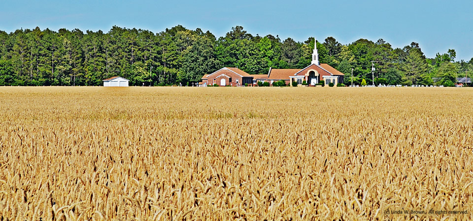
Ripe grain spreads out in front of this rural Clarendon County church, reminding us that we need both bread and faith to survive, writes photographer Linda W. Brown of nearby Kingstree, S.C.
Clarendon County has 34,357 people, according to the U.S. Census Bureau’s 2012 population estimate. About half of the county’s residence are white; the other half are black. Some other statistics:
Photo taken March 2013 by Linda W. Brown. Copyrighted; all rights reserved.
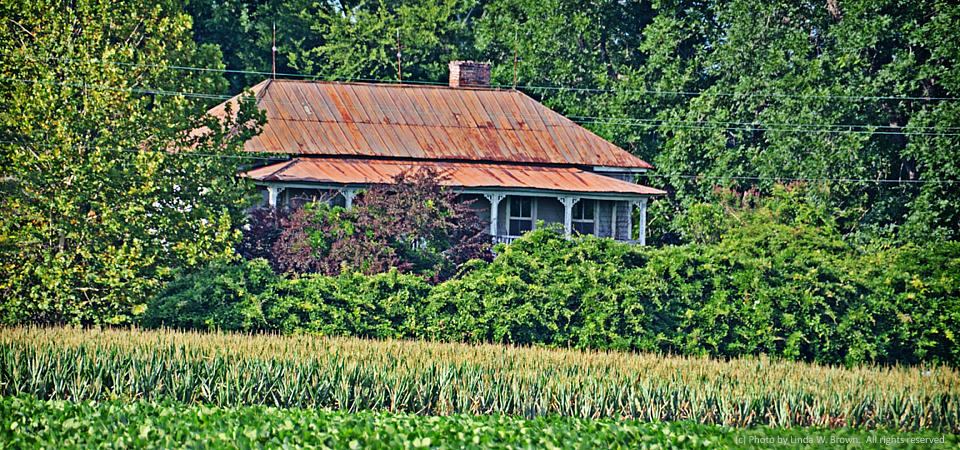
The rusty roof of an empty, old farmhouse overlooks fields that are still planted each year, photographer and retired editor Linda Brown writes from Kingstree, S.C.
The house is on Thurgood Marshall Highway, a few miles outside of Kingstree in Williamsburg County.
Copyrighted photo taken June 29, 2014, by Linda W. Brown. All rights reserved.
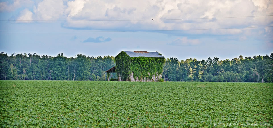
A vine-covered tobacco barn in the middle of a cotton field signals changing times in agriculture in the South and in the Cedar Swamp community of Williamsburg County, S.C., where this barn is located.
Photo taken June 29, 2014, by Linda W. Brown. All rights reserved.
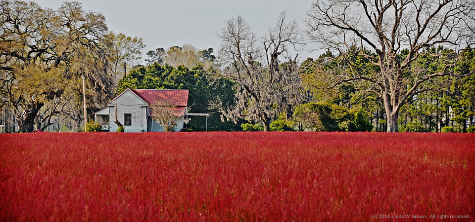
By springtime, most agricultural fields once were under cultivation, writes retired editor Linda W. Brown of Kingstree, S.C. But this Williamsburg County field near Kingstree has been taken over by common sorrel, an herb often viewed as a weed with small bright red to purple flowers. “The changing agricultural outlook leaves many of them [fields] fallow,” she writes.
Williamsburg County, which is about 75 miles north of Charleston, S.C., has a population of just under 34,000 people. Population peaked in 1950 at 43,807, but has dropped slowly since then.
About two-thirds of county residents are black, with almost all of those remaining being white. Only 2 percent of those in the county are of Hispanic descent. Some 32.8 percent of residents live in poverty, according to the Census. Of the county’s 1,921 firms, 36.5 percent are black-owned — a percentage that is three times South Carolina’s average.
Copyrighted photo is by Linda W. Brown; taken April 2013. All rights reserved.
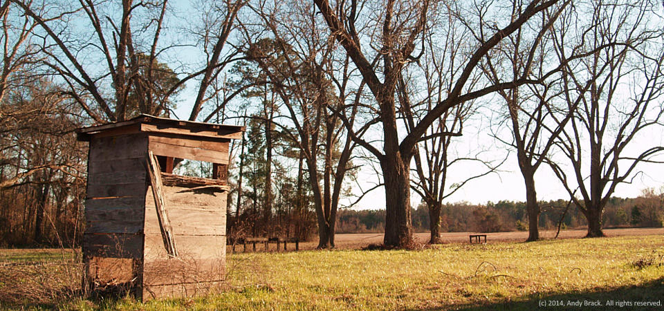
There’s no telling how old this privy is outside an old farmhouse just north of Dexter, Ga., in Laurens County. The unpainted house had some signs that someone might have been restoring it awhile back (new brick foundation in the rear; random concrete blocks at front holding up building.) But there was no electricity going into the place on Georgia Highway 257 near Dexter’s new water tower.
Just beyond the privy, you can see a small grove of seven mature pecan trees with a field in the rear.
Dexter has about 500 people and is a few miles southwest of Dublin, the county seat for Laurens County. Some 23.6 percent of residents of Laurens County (population 48,434) live in poverty.
Photo taken Feb. 15, 2014 by Andy Brack. All rights reserved.