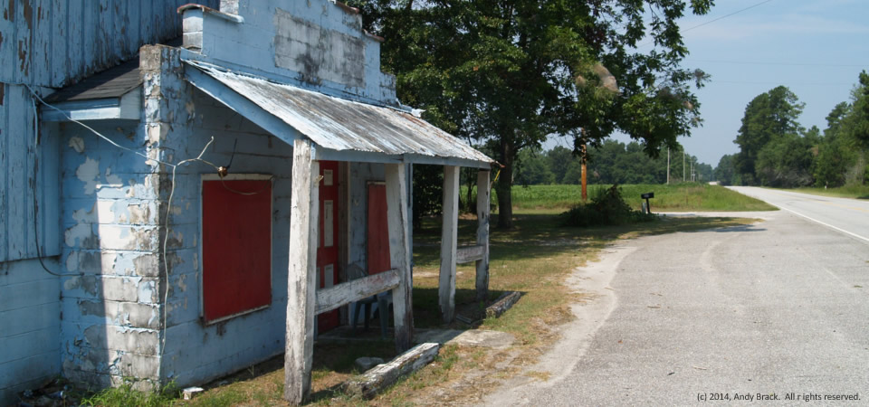
We’re not exactly sure what this old place is, but figure it probably most recently was a rural joint, preceded by being a country store of some sort. Likely as not, there have been some very good times had here. The run-down building, located along S.C. Highway 261 between Manning and Kingstree, S.C., is in agricultural Clarendon County.
Clarendon County has 34,357 people, according to the U.S. Census Bureau’s 2012 population estimate. About half of the county’s residence are white; the other half are black. Some other statistics:
High school graduation rate of those 25 or older: 76.3 percent.
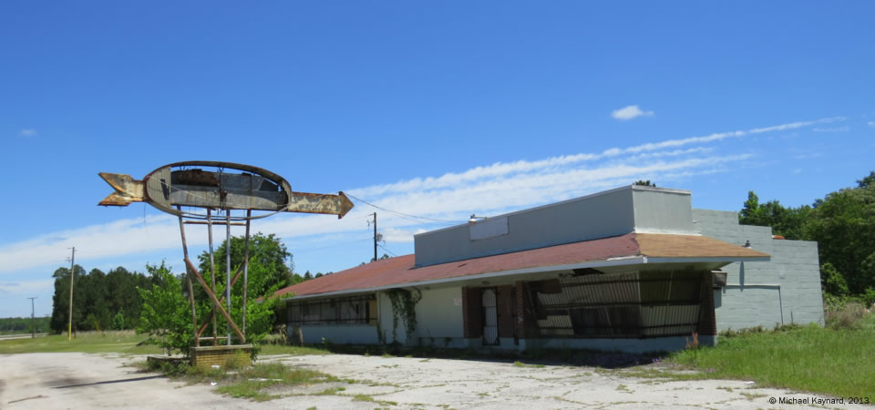
U.S. Highway 301 used to be one of the main north-south arteries for tourists heading south to Florida. But after South Carolina’s construction of its part of now-busy Interstate 95 started in 1969 and ended in 1976 [more], vehicles opted for the fast throughways over highways that slowed traffic in small towns.
This photo, taken in southern Bamberg County near the 301 intersection with S.C. Highway 64, depicts old joint that had few clues about its earlier existence. Charleston photographer Michael Kaynard speculated that the building, now boarded up with insulation pressing against big glass windows, first was some kind of restaurant and gas station which succumbed to being a rural club before withering.
“Driving down Hwy 301 is depressing,” Kaynard writes. “So many businesses are closed. This road was killed by the Interstate and one business after another just could not make it.
“This particular place is somewhat of a mystery. I was attracted by the large arrow, just as travelers were many years ago. There were so many choices that the businesses had to install attention-getting signage to attract customers. The lettering on the sign was so faded that I could not make out a name or what type of business it was. If I had to guess I would think that, originally, it was a combination restaurant and gas station. It would be really interesting to find out if I guessed correctly.”
If anybody has any clues about what this once was, let us know through our contact page.
Photo taken May 6, 2013, by Michael Kaynard, Kaynard Photography, for the Center for a Better South. All rights reserved.