Restored church, Oliver, Ga.

Old Methodist church, Oliver, Ga.

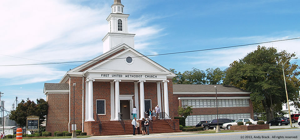
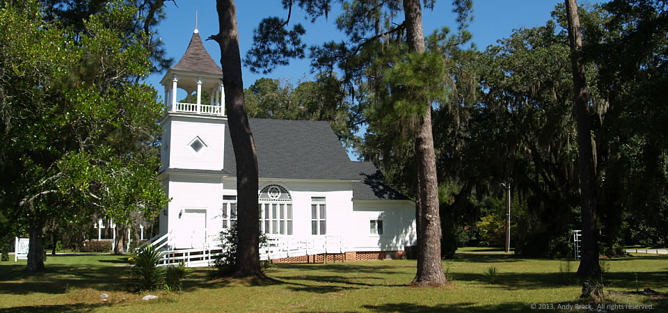
Here’s a photo that’s perfect for Thanksgiving.  It’s an old Methodist church turned into a venue for special events, like today’s holiday.

The church (ca. 1908) in Oliver, Ga., between Statesboro and Savannah sat vacant for about 10 years before being bought and restored three years ago, according to its owner.  Now a venue for weddings and other events, the church is interesting to some because of its Star of David windows.

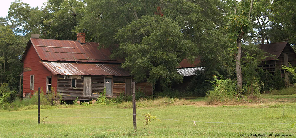
Oliver, population 253 in 2000, is slightly over half black.  An estimated 31 percent of residents are at or below the federal poverty line.  Oliver is in Screven County, which got started after the Revolutionary War and soon became part of the Black Belt of Georgia where cotton became an important staple crop tended by enslaved African Americans.

The county’s population jumped from 3,019 in 1800 to 8,274 by 1860, according to Census figures.  While it had 14,593 people in 2010, the county lost an estimated 391 people — 2.7 percent — by 2012, according to the U.S. Census.  In 2010, Some 25.4 percent of county residents lived below the federal poverty level, 9 points higher than the state average.

Photo taken Sept. 23, 2013, by Andy Brack.  All rights reserved.

Hauling lumber, Cooperville, Ga.

Hauling lumber, Screven County, Ga.


Here’s a typical scene across the rural South — a log truck hauling lumber to be processed into 2x4s or pulverized into pulp for mills.

These days, the forest products market in the U.S. is considered optimistic in the near-term, according to a 2013 report by USEndowment.org.  And that, should help the rural South.  In the longer term, the market faces challenges and opportunities, according to the report.

In the photo above, the truck was turning off U.S. Highway 301 in Cooperville, Ga., in Screven County and heading toward Savannah. The county, which had 2,675 people in 2000, according to the Census, got started after the Revolutionary War and soon became part of the Black Belt of Georgia where cotton became an important staple crop tended by enslaved African Americans.

The county’s population jumped from 3,019 in 1800 to 8,274 by 1860, according to Census figures.  While it had 14,593 people in 2010, the county lost an estimated 391 people — 2.7 percent — by 2012, according to the U.S. Census.  In 2010, Some 25.4 percent of county residents lived below the federal poverty level, 9 points higher than the state average.

Photo taken Sept. 23, 2013, by Michael Kaynard.  All rights reserved.

Paradise Restaurant, Cooperville, Georgia

Empty Paradise Hotel, Cooperville, Ga.

The old Paradise Restaurant, which apparently suffered a fire in recent years, is closed, as is the gas station at right.  Both are adjacent to a spooky old motel featured on Halloween in this post.

The complex is in Cooperville at the intersection of U.S. Highway 301 and Georgia Highway 17 in Screven County, Ga., which got started after the Revolutionary War and soon became part of the Black Belt of Georgia where cotton became an important staple crop tended by enslaved African Americans.

The county’s population jumped from 3,019 in 1800 to 8,274 by 1860, according to Census figures.  While it had 14,593 people in 2010, the county lost an estimated 391 people — 2.7 percent — by 2012, according to the U.S. Census.  In 2010, Some 25.4 percent of county residents lived below the federal poverty level, 9 points higher than the state average.

Photo taken Sept. 23, 2013, by Andy Brack.  All rights reserved.

Spooky, Cooperville, Georgia

13.1031.spooky
Spooky, abandoned motel, Cooperville, Ga.

Doesn’t this abandoned motel look plain spooky — a place NOT to be on Halloween?

It’s in rural Screven County, Ga., about 12 miles south of the county seat, Sylvania, at the intersection of U.S. Highway 301 and Georgia Highway 17.  Next to the hotel is the abandoned Paradise Restaurant, that kind of reminds us of the Lobster House, also in Highway 301, about 45 minutes northeast.

Screven County got started after the Revolutionary War and soon became part of the Black Belt of Georgia where cotton became an important staple crop tended by enslaved African Americans.

The county’s population jumped from 3,019 in 1800 to 8,274 by 1860, according to Census figures.  While it had 14,593 people in 2010, the county lost an estimated 391 people — 2.7 percent — by 2012, according to the U.S. Census.  In 2010, Some 25.4 percent of county residents lived below the federal poverty level, 9 points higher than the state average.

Photo taken Sept. 23, 2013, by Michael Kaynard.  All rights reserved.

Main Street, Rocky Ford, Ga.

Rocky Ford, Ga.
Rocky Ford, Ga.

Rocky Ford, Ga., a circa 1870s town with “untold treasures and endless opportunities” according to this site, is home to about 200 people in rural Screven County in eastern Georgia.

According to photographer Brian Brown, “After putting much of her personal wealth and energy into the restoration of her beloved hometown of Rocky Ford, Greta Newton is now offering its historic commercial core for sale. Without her passion for the history of this place, it would have suffered the same fate as so many of our forgotten small towns in Georgia.”

Rocky Ford is in Screven County, which had 2,675 people in 2000, according to the Census.  Screven County got its start after the Revolutionary War and soon became part of the Black Belt of Georgia where cotton became an important staple crop tended by enslaved African Americans.

The county’s population jumped from 3,019 in 1800 to 8,274 by 1860, according to Census figures.  While it had 14,593 people in 2010, the county lost an estimated 391 people — 2.7 percent — by 2012, according to the U.S. Census.  In 2010, Some 25.4 percent of county residents lived below the federal poverty level, 9 points higher than the state average.

Photo taken Sept. 23, 2013, by Michael Kaynard.  All rights reserved.

Farmhouse in town, Sylvania, Ga.

Farmhouse in Sylvania, Ga.

In many towns across the rural South, it’s not hard to find old homes near downtown that were once at the edge of town.  They blended a little of country and city at the same time.

While decrepit now, this old house might soon be in for an upfit, based on some of the stuff in the yard that’s outside of the picture.  The property sits about two blocks off the main street in Sylvania, Ga.

Sylvania, the county seat of Screven County, had 2,675 people in 2000, according to the Census.  Screven County got its start after the Revolutionary War and soon became part of the Black Belt of Georgia where cotton became an important staple crop tended by enslaved African Americans.

The county’s population jumped from 3,019 in 1800 to 8,274 by 1860, according to Census figures.  While it had 14,593 people in 2010, the county lost an estimated 391 people — 2.7 percent — by 2012, according to the U.S. Census.  In 2010, Some 25.4 percent of county residents lived below the federal poverty level, 9 points higher than the state average.

Photo taken Sept. 22, 2013, by Andy Brack.  All rights reserved.

Storage, Sylvania, Ga.

Agricultural storage, Sylvania, Ga.

Here’s something found in many rural Southern agricultural towns — warehouses and grain elevators.  This operation is run by Daniel W. Reed Co., in Sylvania, Ga.

Sylvania, the county seat of Screven County, had 2,675 people in 2000, according to the Census.  Screven County got its start after the Revolutionary War and soon became part of the Black Belt of Georgia where cotton became an important staple crop tended by enslaved African Americans.

The county’s population jumped from 3,019 in 1800 to 8,274 by 1860, according to Census figures.  While it had 14,593 people in 2010, the county lost an estimated 391 people — 2.7 percent — by 2012, according to the U.S. Census.  In 2010, Some 25.4 percent of county residents lived below the federal poverty level, 9 points higher than the state average.

Photo taken Sept. 22, 2013, by Andy Brack.  All rights reserved.

Church is out, Sylvania, Ga.

Church is out, Sylvania, Ga.

Members of the First United Methodist Church in Sylvania in eastern Georgia are shown leaving church on a fall Sunday.  Despite the fact that Southern states tend to be more conservative than states in other parts of the country, Southerners tend to be more generous with larger percentages of their discretionary income going to charity.

According to the Chronicle of Philanthropy, four Southern states — Mississippi, Alabama, Tennessee and South Carolina — are in the top five most charitable states.  Georgia ranks eighth, according to a 2012 study.

Sylvania, the county seat of Screven County, had 2,675 people in 2000, according to the Census.  Screven County got its start after the Revolutionary War and soon became part of the Black Belt of Georgia where cotton became an important staple crop tended by enslaved African Americans.

The county’s population jumped from 3,019 in 1800 to 8,274 by 1860, according to Census figures.  While it had 14,593 people in 2010, the county lost an estimated 391 people — 2.7 percent — by 2012, according to the U.S. Census.  In 2010, Some 25.4 percent of county residents lived below the federal poverty level, 9 points higher than the state average.

Photo taken Sept. 22, 2013, by Andy Brack.  All rights reserved.