Empty joint, Bamberg County, S.C.

13.0506.joint_mk
Empty joint, 13 miles south of Bamberg, S.C.


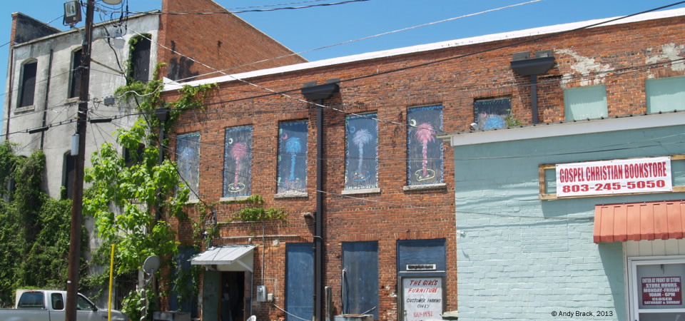
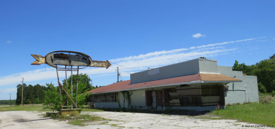
U.S. Highway 301 used to be one of the main north-south arteries for tourists heading south to Florida.  But after South Carolina’s construction of its part of now-busy Interstate 95 started in 1969 and ended in 1976 [more], vehicles opted for the fast throughways over highways that slowed traffic in small towns.

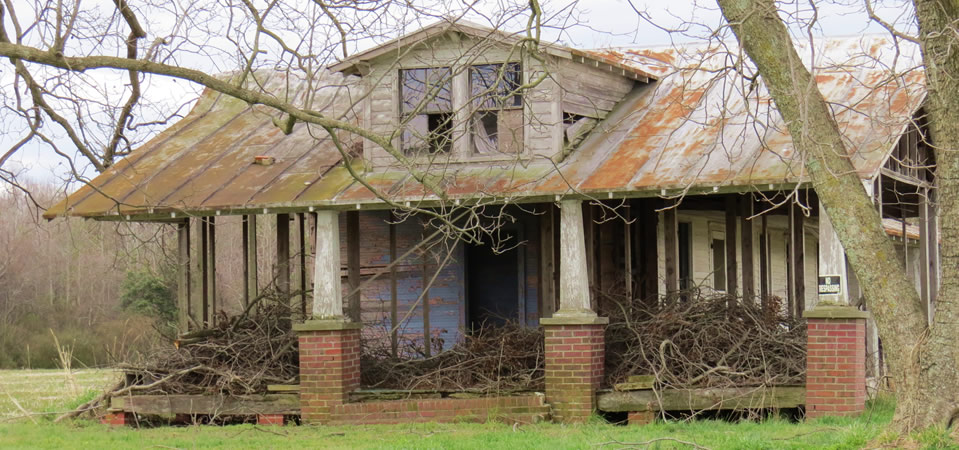
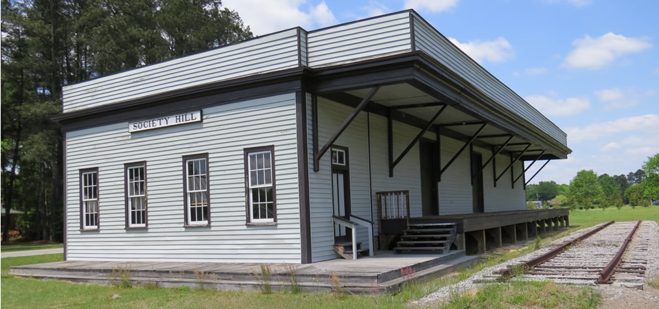
This photo, taken in southern Bamberg County near the 301 intersection with S.C. Highway 64, depicts old joint that had few clues about its earlier existence.  Charleston photographer Michael Kaynard speculated that the building, now boarded up with insulation pressing against big glass windows, first was some kind of restaurant and gas station which succumbed to being a rural club before withering.

“Driving down Hwy 301 is depressing,” Kaynard writes.  “So many businesses are closed.  This road was killed by the Interstate and one business after another just could not make it.

“This particular place is somewhat of a mystery.  I was attracted by the large arrow, just as travelers were many years ago.  There were so many choices that the businesses had to install attention-getting signage to attract customers.  The lettering on the sign was so faded that I could not make out a name or what type of business it was.  If I had to guess I would think that, originally, it was a combination restaurant and gas station.  It would be really interesting to find out if I guessed correctly.”

If anybody has any clues about what this once was, let us know through our contact page.

Photo taken May 6, 2013, by Michael Kaynard, Kaynard Photography, for the Center for a Better South.  All rights reserved.

Old city hall, Bamberg, S.C.

Alleyway, Bamberg, S.C.

The South is filled with alleyways like this one from rural Bamberg, S.C.  The two-story building at left with vines crawling up the side is the back of the town’s old city hall, now empty and vacant on the main drag, U.S. Highway 301.  In the middle, you can see how owners of a furniture store made boarded-up back windows more attractive by portraying various colored Palmetto trees, the state symbol.

As mentioned in an earlier post, just over 30 percent of the 15,987 people in Bamberg County in 2010 lived below the poverty level, according to the U.S. Census.  The majority of residents are black (61.5 percent) with whites comprising 36.1 percent.   Some 1.6 percent of residents are Latino while 0.4 percent are of Asian descent.

Photo taken May 6, 2013, by Andy Brack, president of the Center for a Better South

Man reading newspaper, Bamberg, S.C.

13.0506.sc_bamberg1

A elderly Hindu man reading what appeared to be an Indian newspaper outside of an old motor court on Main Street in Bamberg, S.C., represents how more foreign-born people are moving into the rural South.  The man, who couldn’t speak English, was identified by a hotel employee as “Mr. Patel.”  His stark white, pressed outfit stood out on a sunny day in the parking lot of the Relax Inn against the bright blue doors of its 22 rooms.

“At first, I was surprised to see someone of Indian descent in Bamberg,” said Charleston photographer Michael Kaynard, noting that S.C. Gov. Nikki Haley, also of Indian descent, grew up in Bamberg.  “But I figured his family probably followed another family to this rural town.

“It reminded me that my grandparents emigrated to the United States around 1900 and they came to avoid oppression.”

Just over 30 percent of the 15,987 people in Bamberg County in 2010 lived below the poverty level, according to the U.S. Census.  The county included 254 people born outside of the United States.   The majority of residents are black (61.5 percent) with whites comprising 36.1 percent.   Some 1.6 percent of residents are Latino while 0.4 percent are of Asian descent like Mr. Patel.

Photo taken May 6, 2013, by Michael Kaynard, Kaynard Photography.


Rural church in 1939, near Manning, S.C.

13.0506.sc_manning_wolcott

During the Great Depression, the Farm Security Administration hired documentary photographers like Marion Post Wolcott to take photographs of rural and small-town life across the country to highlight the effects of economic stagnation. The collection offers more than 164,000 black-and-white photos and 1,600 color photos taken from across the nation.

What’s interesting about this 1939 photo by Wolcott, described as “A Negro church in a corn field” near the South Carolina Crescent town of Manning in Clarendon County, is how it could have been taken just as easily today, 74 years later.  According to the 2010 Census, almost 21 percent of Clarendon County residents live in poverty.


Empty home, near Pleasant Hill, N.C.

13.0501.nc_pleashill_house


Here’s a photo of an empty home near the decaying barn published on May 3.  Observes photographer Michael Kaynard:

“What struck me was the classic design of the roof line and porch columns.  My wife and I love this type of porch and could see ourselves sitting outside in the afternoon watching the day turn into dusk.

“We were drawn to it because it at first appeared to be overgrown with vines.  When we got a better look it appeared that the vines had been chopped and left on the porch.  You can still see some of the curtains hanging in the upstairs window.

“I feel a sadness when I see these once beautiful buildings that have been abandoned to the elements.  In this case, I did not see a newer farmhouse nearby.  So, what happened to the people who once lived here?”


New project focuses attention on Southern Crescent

The new Southern Crescent project by the Center for a Better South is an effort to draw attention to underserved areas of the American South to help coordinate better delivery of services to the area’s people.

  • See the new Web site that highlights areas in the Crescent.  as it stretches from Tidewater Virginia through the Carolinas and middle Georgia and then northwesterly toward the Mississippi Delta. [NOTE: The Southern Crescent Web site has since been absorbed into the Better South site that you’re using.]

Below at left in a map that shows the higher rate of diabetes in the South, you can see the general outline of the Crescent, the geographic area that stretches from the Tidewater part of eastern Virgina southward through the Carolinas along Interstate 95.

Diabetes rate, males, 30+, 2008, via Nature.com

Diabetes rate, males, 30+, 2008, via Nature.com

It then turns west through Georgia and lower Alabama before curling northwesterly to the Mississippi Delta.  Home to millions, this soft underbelly of the American South has been underserved for generations.  It has a higher than normal incidence of poverty, unemployment and health problems that stretch through nine states.

This Web site provides weekly looks at communities in the Crescent to help people better understand challenges in the region.  You can help by donating money to bolster our efforts or, if you live in the Crescent, submitting pictures of people and places throughout the area.

Less than high school education, 2010

Less than a high school education, 2010
Source:  U.S. Census with image by Center for a Better South via Social Explorer.com

Counties colored with darker shades of green have an increasingly higher rate of people with less than a high school education.

EDUCATION10k_chart
Population 25 and over with less than a high school education, American Community Survey, 2006-10, U.S. Census.


Income less than $10,000 a year, 2010

Income less than $10,000 a year, 2010

Source:  U.S. Census with image by Center for a Better South via SocialExplorer.com

INCOME10k_chart
Household income less than $10,000, American Community Survey 2006-10, U.S. Census.

The green counties have a comparatively higher level of families making $10,000 or less in a year.


Median household income, 2010

Median household income, 2010

Source:  U.S. Census, image by Center for a Better South via SocialExplorer.com

Median household income, American Community Survey, 2010,5-year estimate, U.S. Censusl

Median household income, American Community Survey, 2010,5-year estimate, U.S. Censusl

The maroon and pink counties indicate a lower median household income.